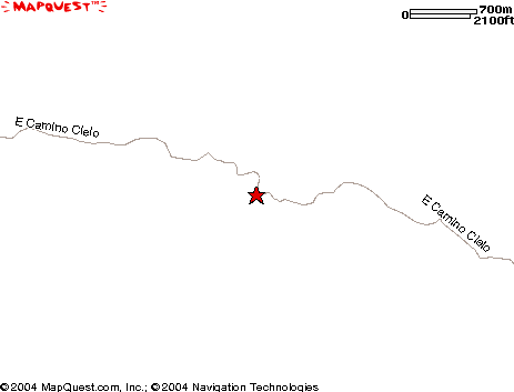
Cold Spring Trailhead at Camino Cielo Trailhead Map
Trails to Forbush Flats, the Santa Ynez River, Cottam, Blue Canyon, and other destinations start from this trailhead.
From Santa Barbara Mission, drive 0.7 miles towards the mountains. At the first stop sign, turn right on Foothill Rd. and continue for 0.8 miles. Turn left onto Mountain Dr., go 0.6 miles, keeping to the left at Sheffield Reservoir. Bear right at the junction with Gibraltar Road. Drive 6.7 miles on Gibraltar Road. This is a steep, winding road to the top of the mountain. Turn right at Camino Cielo, go 3.7 miles and park at the first concrete water tower on the right. This last section affords great views of the coastline but driving can be dangerous due to the condition of the road. Total distance from Santa Barbara Mission is 12.5 miles.
|